Search by voice
Windows
Mac
Windows
Log in / Sign up
Windows
›
Tags › data contouring
Featured
Data Contouring
Software
Relevance
Popularity
Rating
Global Mapper
26,585
Blue Marble Geographics
Global Mapper is an easy-to-use spatial data management tool for GIS mapping...
over 250 different spatial
data
formats including...and terrain creation, and
contour
generation
RockWorks
2,556
RockWare
RockWorks is a comprehensive software program that was developed...
assist users in performing
contouring
, 2D and 3D surface...Furthermore, it has
data
tools that can
Dips
2,170
Rocscience Inc.
Dips is designed for the interactive analysis of orientation based geological...
of orientation based geological
data
. The program is capable...the analysis of geological
data
Voxler
941
Golden Software, Inc.
Voxler transforms your data into comprehensive 3D models that ease decision making...
It can present
data
...Point cloud, LiDAR,
Contour
, Block, Streamline, and Vector
3DField
281
Vladimir Galouchko
3DField is a contouring surface plotting and 3D data program that helps the user to build 2D/3D maps...
3DField is a
contouring
surface plotting and 3D
data
program that helps
3DFieldPro
106
Vladimir Galouchko
3DFieldPro is a contouring plotting and 4D-3D data program. It converts your data into contour maps...
is a
contouring
plotting and 4D-3D
data
program...It converts your
data
into
contour
maps, surface
Wafermap
free
82
Boin GmbH
WAFERMAP is an award winning software package used to collect...
WAFERMAP can import
data
files from various metrology...printed as line scans,
contour
plots, 2D
Visual Data
47
GraphNow
Visual Data is a scientific data visualization application to create 3D surface...
Data
is a scientific
data
visualization application to create 3D surface,
contour
DiaConnect
free
35
DiaConnect
The DiaConnect is an application that allows you to easily share your USB glucosemeter...
your USB glucosemeter
data
with your healthcare...your
Contour
Next,
Contour
USB or
Contour
StrataExplorer
34
GAEA Technologies Ltd.
StrataExplorer is an application suite for subsurface mapping and data management...
subsurface mapping and
data
management...sections, fence diagrams,
contour
maps, and 3D displays
Petrolog
29
Crocker Data Processing
Petrolog is a specialized log data management, petrophysical and imagelog analysis platform...
a specialized log
data
management, petrophysical...tool which includes
contouring
capabilities
DataScene
29
CyberWit, Inc.
DataScene is a scientific graphing, animation, data analysis, and monitoring program. The user can easily plot 2D...
graphing, animation,
data
analysis, and monitoring...graph, Bar graph,
Contour
graph, Pie graph
GEPlot
14
Enviroware srl
GEPlot is a Windows application for plotting contour lines and grids in Google Earth. With GEPlot you can plot...
Windows application for plotting
contour
lines and grids...plot your geographical
data
the LI Contour V+ Demonstration Copy
9
A B Consulting Co., Inc.
LI Contour is a program that displays and prints maps produced from X,Y,Z survey data. What makes LI Contour versatile...
of LI
Contour
for general
contour
mapping...calculations or
data
transformations are performed
GW Contour
3
Waterloo Hydrogeologic, Inc.
GW Contour is the first data interpolation and contouring program to also incorporate...
range of projects. New
Data
Contouring
and Modeling
1
2
3
4
Tags
Data
Map
Contour
Data analysis
3D data
Contour map
Scattered points
3d maps
View
Plot
Featured stories
See all
Mobile Data Transfer. Part II: iOS → PC
The second part of the series is about various types of batch moving different types of files from an iOS device to PC or laptop.
Best tools to perform iOS → PC data transfer
If you're looking for a tool to help you transfer files from your iPhone or iPad to Windows computer, here are some of the best solutions available.
Why does Windows 10 collect your data?
Most of you already know that Windows 10 is keeping tabs on its users collecting loads of data from them, but have you ever wondered why it does that? Here's the answer.
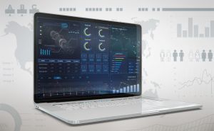
Best Data Analysis Tools in 2022
By instigating Data Analysis Tools, individuals and companies can expedite decision-making, gain new customers, enhance customer experience, and become future-proof.
The GFS backup strategy: never lose your data (again)
The Grandfather-Father-Son backup strategy may feel cumbersome at the outset, but it does the job of keeping your data save. Let's see how it works, and what solution enable it.